UK Map Wall Display for Secondary School Education
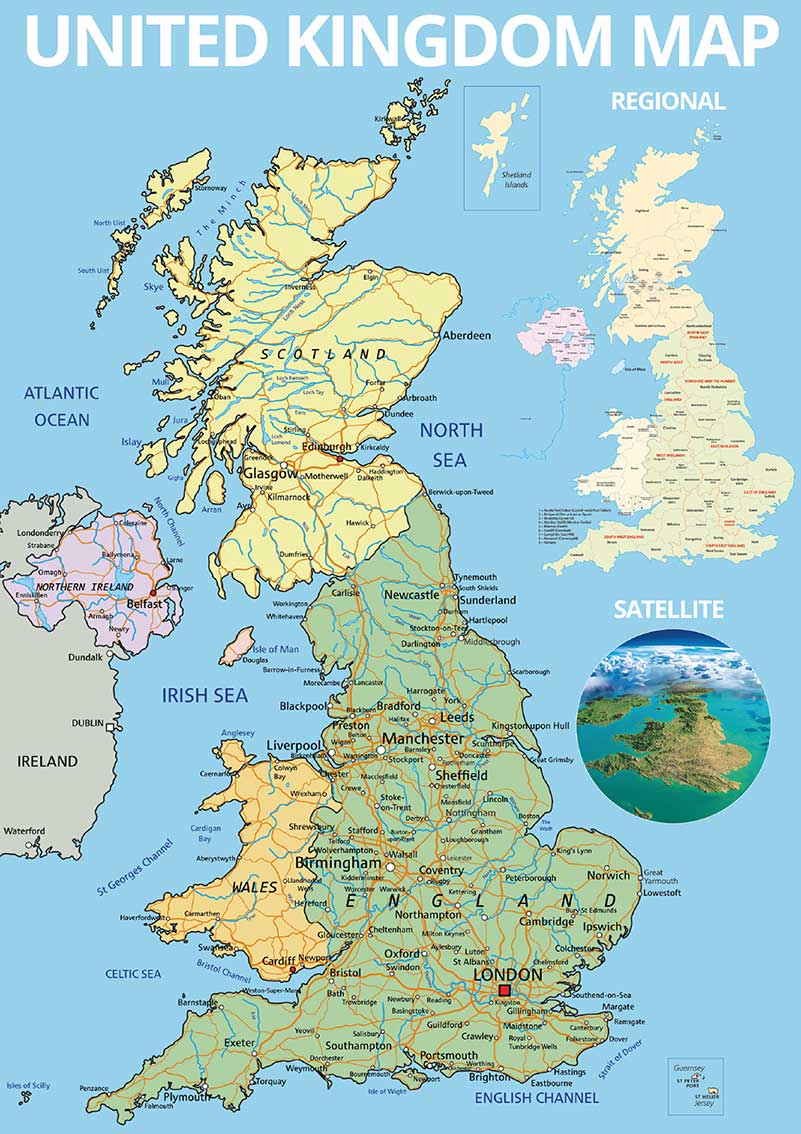

This UK geography lesson map includes all the major towns and cities, rivers, seas, and oceans. In addition, there is a regional map showing all the regions and counties throughout the UK. The final element is a satellite image of the UK to give a feel for the topography of the UK.
Available in 3 sizes this piece of wall art can be installed in both indoor and outdoor environments.
Please select
(Shipping not included)
Payment Options
Pay by Credit Card or
Pay by Invoice (within 7 days*)
This UK geography lesson map for secondary schools includes all the major towns and cities, rivers, seas, and oceans. In addition, there is a regional map showing all the regions and counties throughout the UK. The final element is a satellite image of the UK to give a feel for the topography of the UK. The display can be used as a teaching aid or as a reminder for students of the things they are covering in lessons. In addition to being a practical tool, the vibrant design will enhance any learning environment creating a fun and inspirational space. Available in 3 sizes this piece of wall art can be installed in both indoor and outdoor environments. The graphic is printed in full colour onto 5mm thick rigid foam boards (Indoor) or 3mm thick composite aluminium (Outdoor) using UV-guaranteed inks with the addition of a protective plastic laminate. They are easy to install and we are happy to provide advice on the best method depending on the surface.
Additional information
| Indoor or Outdoor Display | Indoor, Outdoor |
|---|---|
| Size | A0, A1, A2 |